How do I get from…?
Connections to/from Václav Havel Airport
| Line Timetable |
Direction | Possible transfer | Travel time to city center | Ticket price |
|---|---|---|---|---|
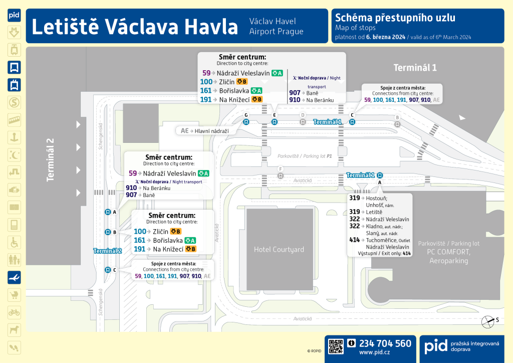
| 59 | Airport ⇆ Veleslavín Station | Metro line A | approx. 35 minutes | 50 CZK App: 46 CZK / SMS: 55 CZK |
| 100 | Airport ⇆ Zličín | Metro line B | approx. 45 minutes | 50 CZK App: 46 CZK / SMS: 55 CZK |
| AE | Terminal 1 ⇆ Main Railway Station | Metro line C and trains | approx. 45 minutes | 200 CZK |
| 907🌙 | Terminal 2 ⇆ Baně | night lines | approx. 50 minutes | 50 CZK App: 46 CZK / SMS: 55 CZK |
| 910🌙 | Terminal 2 ⇆ Na Beránku | night lines | approx. 45 minutes | 50 CZK App: 46 CZK / SMS: 55 CZK |
Distinction of Stops Terminal 1 and Terminal 2
Terminal 1
Serves non-Schengen flights.
Examples of countries: USA, United Kingdom, Canada, Australia, Japan.
Terminal 2
Serves flights within the Schengen area (EU countries, etc.).
Examples of countries: Germany, France, Italy, Spain, Poland.
Ticket Purchase and Validation
For travel on standard PID lines, the following tariffs apply. Ticket prices vary depending on the purchase method:
- 30-minute ticket: Paper: 39 Kč | App: 36 Kč | SMS: 42 Kč
- 90-minute ticket: Paper: 50 Kč | App: 46 Kč | SMS: 55 Kč
24-hour and 72-hour Tickets in PID
For passengers planning a longer stay in Prague or wanting to move comfortably around the city without constantly buying individual tickets, short-term tickets valid for 24 or 72 hours are suitable. A paper ticket must be validated only once – validity is counted from the moment of validation. The same rule applies to 24 and 72-hour tickets – validate only once, on the first trip. Repeated validation invalidates the ticket.
- 24-hour ticket (1 day): Paper: 150 Kč | App: 140 Kč | SMS: 150 Kč
- 72-hour ticket (3 days): Paper: 350 Kč | App: 340 Kč | SMS: 350 Kč
In the Prague Integrated Transport system, it is not possible to purchase a group ticket for multiple passengers in Prague. In practice, this means that each passenger must have their own ticket. 24 and 72-hour tickets are transferable and valid for all means of Prague Integrated Transport (PID), including metro, trams, buses, trolleybuses, suburban trains (tariff zones P, 0, B), the Petřín funicular (closed until 2026), and ferries. They do not apply to lines with special tariffs, such as Airport Express (AE).
Tickets for Luggage and Dogs
If traveling with luggage in PID, luggage (max 25×45×70 cm) is transported free of charge. If the size is larger, it is necessary to pay a single ticket of 20 Kč for the luggage, which has the same time validity as the passenger’s travel document, maximum 180 minutes. If traveling with a dog, all information can be found on the special page – Traveling with a Dog.
Where to Buy Tickets
- In ticket machines at stops, in metro vestibules, and at the airport.
- In information centers of the Prague Public Transit Company (DPP) – DPP counter in the area of Terminal 1 and Terminal 2 in the public area
- From selected sellers, for example, in newsstands.
- Via the mobile app PID Lítačka.
- In the form of SMS ticket
- On contactless payment terminals in all city transport vehicles
Ticket Validation
Printed tickets requiring validation must be validated on the first boarding of the vehicle or in the metro vestibule in the validator (yellow), at airport stops in validators right on the platform. The ticket is validated only once – validity is counted from the moment of validation. The same rule applies to 24 and 72-hour tickets – validate only once, on the first trip. Tickets purchased via mobile app, contactless payment terminal, or SMS (SMS ticket must be received) are valid automatically according to the purchase time (after the protective period of 60 seconds), or in the PID mobile app with later manual activation. 24 and 72-hour tickets are a good choice for tourists and locals planning to intensively use public transport in Prague.
Notice: A paper ticket must be validated only once – validity is counted from the moment of validation. The same rule applies to 24 and 72-hour tickets – validate only once, on the first trip. Repeated validation invalidates the ticket.
Free Travel in Prague
In the territory of the capital city of Prague, some passengers can use public transport for free. Below is an overview of who is entitled to this benefit:
| Category | Proof of Entitlement to Discount | Validity |
| Children under 6 | Travel free without the need for a document. | Applies to foreign passengers as well |
| Children 6 – 10 years | Travel free without the need for a document. | Applies to foreign passengers as well |
| Children 10 – 15 years | Free travel only with a valid card – e.g. Lítačka with confirmed age, school ID or ISIC card with date of birth, passport, children’s ID card. | Applies to foreign passengers as well |
| Seniors from 65 years | Travel free automatically, just prove with any identity document with date of birth (passport, ID card). | Applies to foreign passengers as well |
| Persons with ZTP and ZTP/P | Travel free throughout Prague, except trains. Accompaniment of the ZTP/P card holder is also entitled to free travel. In case of control, it is necessary to prove with a valid ZTP or ZTP/P card issued in the Czech Republic. | Applies exclusively to cards issued in the Czech Republic |
| Accompaniment of a child under 3 years | Travels free, just prove with the child’s identity document, or a special PID card. | Applies to foreign passengers as well |
Fare Inspection
If you travel by public transport in Prague and violate the PID transport conditions, you may be imposed a surcharge to the fare (fine). Here is an overview of the most common situations.
Travel without a Valid Ticket
- 2 000 Kč – basic fine
- 1 200 Kč – when paid on the spot
- 1 500 Kč – when paid within 15 days
Typical cases: no ticket, unactivated ticket, expired ticket or ticket for other tariff zones.
Important Information for Tourists
- Paper ticket is validated only once on the first trip
- Ticket in the PID Lítačka app must be activated before boarding (min. 60 seconds) – in the metro before entering the paid area
- Unactivated ticket is considered invalid, even if the app is running the period until full ticket activation
- Against a fine paid on the spot there is no appeal regardless of legitimacy
- In case of need, the inspector has the right to assistance from the Czech Police
How to Recognize an Inspector?
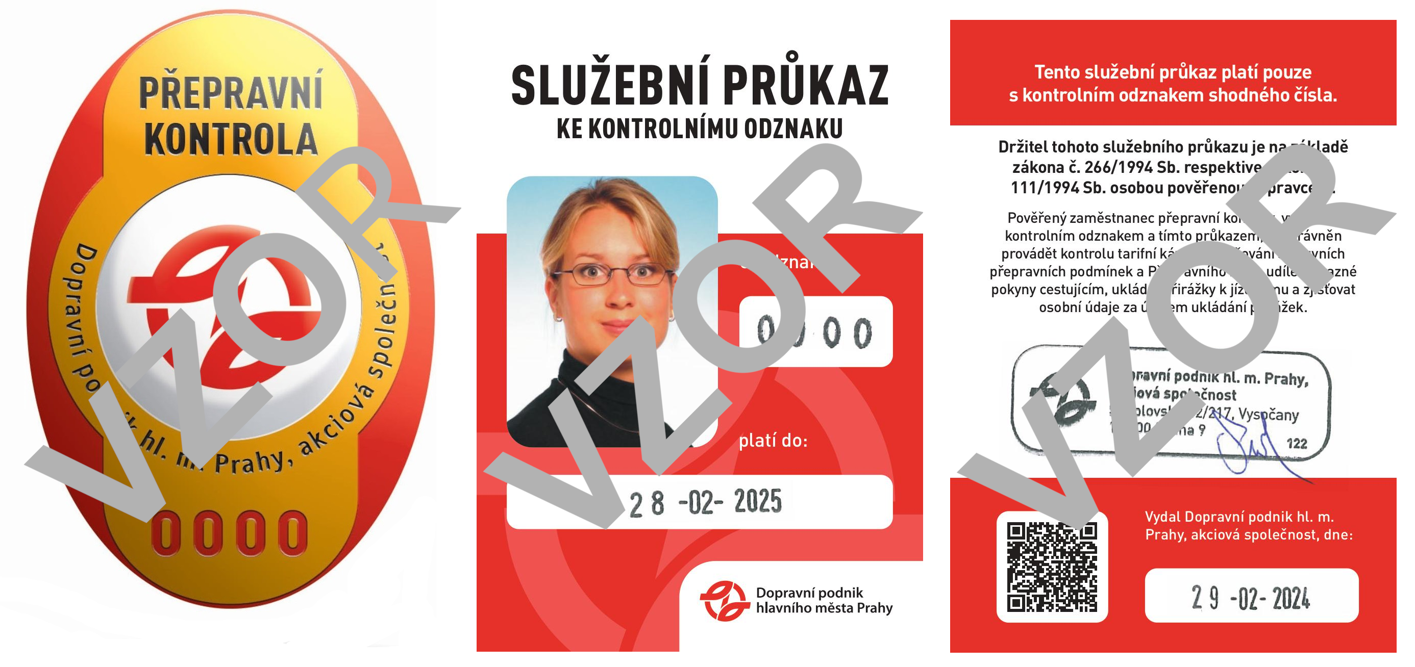
Validity of travel documents can be checked by a person authorized by the carrier, i.e. driver or fare inspector, equipped with a control badge or carrier’s ID (hereinafter authorized person). Inspectors do not have to, but may be in uniforms.

Notice: Personal data of passengers who did not pay the imposed surcharge directly at the control site are kept in the automated DPP system in accordance with the provision of § 5, para. 2, letter e) of the Personal Data Protection Act No. 101/2000 Coll. as amended and in this sense can be used for recovery of the due amount and also transferred to a law firm, courts, and executors.
Controls are carried out by inspectors of the Prague Public Transit Company. Details at www.dpp.cz.
Prague Main Railway Station
If you arrive in Prague by train, you will most often arrive at Prague Main Station. From the platform, you can enter the underpass and then the station hall. One floor below, you will find
ČD CENTER, where the PID Information Center is located. It is open from 08:00 to 18:30 (with a break 12:00-12:30).
In the second part of the large station hall, there are exits from the station and entrances to the metro line C station. Two DPP Information Centers are located there, open on weekdays from 06:00 to 22:00, and also on weekends. For detailed orientation, you can view this railway station map.
In the hall, you will find a shopping area, restrooms with changing tables, luggage storage or lockers, Czech Police office, currency exchanges, ATMs, pharmacy, and restaurants.
View Opening Hours
| Service | Opening Hours |
|---|---|
| Station Hall | 00:00 – 01:15, 02:30 – 24:00 |
| ČD Ticket Counters | 02:40 – 00:40 |
| PID Information Counter | 08:00 – 18:30 |
| DPP Information Center | 06:00 – 22:00 |
| Luggage Storage | 06:00 – 23:00 |
Florenc Bus Station
The Florenc bus station is located just a few minutes from the historic center and is well connected to public transport – right here you will find Florenc metro station (line B and C), as well as stops for several tram and bus lines.
- Quick access to the center – just 5 minutes by metro to Wenceslas Square
- Services in the area: luggage storage, toilets, information center, restaurants and cafes
- Easy connection to further transport – metro, trams, taxi
For detailed orientation, you can open the check-in hall map.
View Opening Hours
| Service | Opening Hours |
|---|---|
| Bus Station Operating Hours | 03:00 – 00:00 |
| Check-in Hall H1 | 05:00 – 00:00 |
| Check-in Hall H2 | 03:00 – 00:00 |
| Luggage Storage H1 | 06:00 – 23:30 |
| Luggage Storage H2 | 06:00 – 22:00 |
How to Get to the Center
The Prague metro represents the backbone of urban public transport and offers fast, reliable, and clear connections across the capital. Every day, it is used not only by Prague residents but also by hundreds of thousands of visitors who easily and efficiently travel to explore sights, to work, or for entertainment.
The metro consists of three lines, distinguished by colors:
-
Line A (green) – connects the western and eastern parts of the city and passes through, for example, Malostranská, Staroměstská or Muzeum.
-
Line B (yellow) – connects the southwest with the east, including important stops like Anděl, Můstek, Florenc or Černý Most.
-
Line C (red) – is the oldest and most used, runs from north to south and serves also Main Railway Station and Florenc station (bus station).
All lines intersect in the city center and thus form easy transfers. The metro runs daily approximately from 5:00 to midnight with short intervals during peak and off-peak hours.
Night Operation
Night operation between 0:00 and 4:30 seamlessly connects to daytime services and ensures comfortable travel even during late hours.
- The backbone of night transport is trams: A total of 9 tram lines (91–99) run at regular 30-minute intervals. The main transfer point is the Lazarská stop, where all night trams meet. Some lines also intersect at other places.
- Night buses: Bus lines 901–917 transport passengers throughout Prague at 30 or 60-minute intervals. At important nodes, they are connected to night trams or other bus connections, so traveling the city at night is smooth and simple.
- Night connection to the airport without transfer: Line 907, 910 directly from the center – for example from I. P. Pavlova or Náměstí Republiky it takes only 45 minutes. Runs every 30 minutes.
- On all night lines, the same tickets as during the day apply – whether single or subscription.


